Facts at a Glance
Currency Local currency is the Pula (P), and Thebe (T). Notes are in denominations of P5, P10, P20, P50 and P100. Coins are in denominations of 1, 5, 10, 25 and 50 Thebe, P1 and P2.
A Dollar is A Dollar
The US Dollar is the currency of preference. When you are tipping, or purchasing at craft-markets, it helps to be carrying $2 and $5 bills.
The reason for the preference in the informal business trades is that it makes trade easier across borders like Zambia and Zimbabwe, obviating the need to convert between local currencies. One dollar is one dollar. No Conversion!
Languages The official language is English and the national language is Setswana. The Setswana word "Pula", means "rain".
Population 1.3 million (1991 census), projected to reach 1.7 million by the year 2001, 2.6 million by the year 2021. An estimated 180 000 people live in Gaborone, the capital, with more than 65 000 in Francistown.
Botswana's World Records
World's largest salt pans - the Makgadikadi Pans are the largest salt pans in the world with an area of about 12 000 sq km
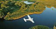
World's largest inland delta - the Okavango delta is the largest inland delta in the world covering about 15 000 km2
World's shortest border - the border between Botswana and Zambia is, at 700 meters, the shortest border between two independent countries.
Botswana Flag

Many of the flags of Africa reflect red and black to depict Liberation Wars and struggles but Botswana's flag is predominantly blue to depict peace and harmony in the country.
The blue of the flag represents water and rain, which mean prosperity in this mainly arid country and the black represents black Batswana and the white represents white Batswana - and together the flag depicts racial harmony and peace.
Source of the Limpopo
The Limpopo River was made famous as the 'great, gray greasy' river of Kipling's story and journals of early explorers and adventurers recount tales of the river that accesses three countries, forming the border between Botswana and South Africa and then South Africa and Zimbabwe.
What is not generally known is that the Limpopo has its source just south of Gaborone where it is known as the Ngotwane River, changing its name to Limpopo near Parr's Halt.
The Cutline Grid
There are many very straight roads in the southern parts of Botswana and from the air a number of straight lines can be seen on the ground, some cleared and some seemingly overgrown. These are from the diamond prospecting days when graders were used to clear straight grid lines on the ground for the prospecting.
The diamond corporation De Beers needed a checkered grid to assist in the prospecting and today many of these clearings have been incorporated into the road network, whilst other have been left to grow over.
Botswana Democracy in Action
Democracy has always been important in Botswana and in all villages there is a meeting place where the villagers meet to discuss matters of importance. Known as a Kgotla this is a tribal court and no decisions are made until everyone has had a chance to have their say.
There is no regard to social standing at the Kgotla and each adult member of the community can share their ideas or concerns. Once everyone has said their piece then a decision is taken as to solutions.
 More than 3-quarters of Botswana is Kalahari Desert, so the huge emerald waterworld full of African animals known as the Okavango Delta, is ...